EnvironmentWeb solutions
Simulation of Extreme Flooding for Skopje Planning Region
Client
SmartUp - Social Innovation Lab — End-client: UNDP MK / City of Skopje
Year
2019
Categories
Environment, Web solutions
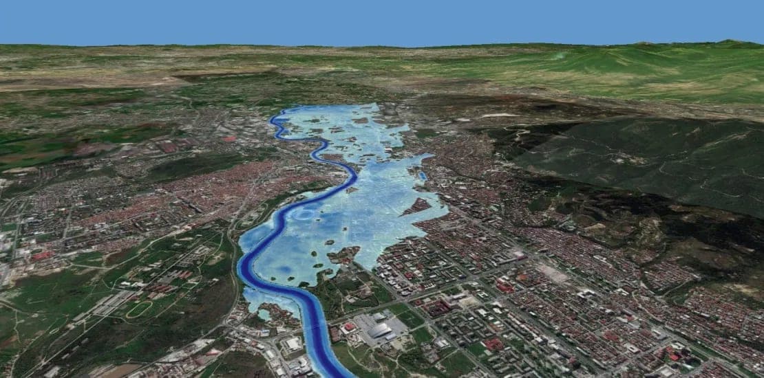
Flood Story Map with the cities ArcGIS system; showing multiple scenarios and correlations of flooding, erosion and so forth.
The modeling effort resulted in the preparation of GIS-based maps that are used for the development of different scenarios of eventual future flood waves, and thus supports the flood risk assessment process through improved preparation of scenarios and plans for floods on the territory of the City.
- Simulation of extreme flooding from the Upper Vardar river part & destruction of the Kozjak dam
- Simulation of the extreme flooding from the 6th of August, 2016 in the Skopska Crna Gora region
- Simulation of extreme flooding from Upper Vardar and Lepenec
- Simulation of flooding from torrential watercourses
Project Images
